Company Profile
 GEOMA™ is the GIS division of Geraldton Community Forest Inc. (GCF). Created in 2007, GEOMA was derived from the Gaelic word Teoma meaning “expert”. GEOMA was developed to better represent and market the GIS division of GCF. Along with the creation of GEOMA, GCF trademarked all products produced by the company to further its marketing strategy.
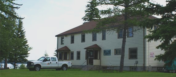
The GCF/GEOMA head office is located in Northwestern Ontario within the Municipality of Greenstone. In 1994, a GIS was implemented at GCF that focused on the forest industry. Work included forest management plans, forest resource inventories and annual work schedules. In 2004, GCF’s GIS department expanded to include projects such as forest fire mapping and GPS contracts with the Ontario Ministry of Natural Resources (MNR). Now a division of GCF, GEOMA is involved with Municipal GIS, forest fire mapping, map product creation, online, interactive, virtual mapping applications and many other GIS projects throughout Ontario.
GEOMA is currently focusing on tourism, municipal, First Nations, forestry and geological GIS to promote Northern Ontario and to benefit the Northern economy.
GCF/GEOMA has had a long standing relationship with many Federal and Provincial funding agencies such as FedNor and the Northern Ontario Heritage Fund Corporation (NOHFC). Our organization has used this relationship to assist in securing funding for projects both as the lead applicant and as the technical advisor for clients.
GEOMA’s staff are proficient in many GIS fields such as programming, cartography, project management, and graphic design. GEOMA’s wide range of backgrounds come from GIS applications, natural resource management, environmental biology, biology and geography.


